Nina Out and About contains affiliate links and is a member of the Amazon Services LLC Associates Program. If you make a purchase using one of these Amazon links, I may receive compensation at no extra cost to you. See my Disclosure Policy for more information.
23 Amazing Hiking Trails on Manitoulin Island, Ontario
Looking for hiking trails on Manitoulin Island?
Whether you want a challenging trail with an amazing view or a calming forest stroll, I’ve got you covered.
Hiking is one of my favorite things to do.
My roommate and I went hiking on Manitoulin Island during one of our road trips. The scenery is stunning and definitely worth the trip.
Many trails are open all year. Others are only open from spring through summer, so pay special attention and make sure your desired trail is accessible.
Here are 23 of the best hiking trails on Manitoulin Island! Take a look at the following options and pick your adventure.
1. Cup and Saucer Trail
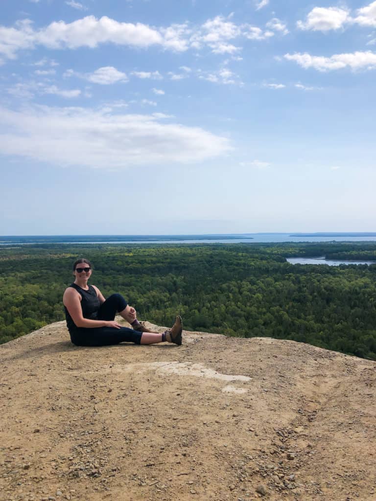
One of the most popular hiking trails on Manitoulin Island is the Cup and Saucer Trail. It is moderately difficult to hike, so be sure you are in decent shape and prepared.
You can decide to do the full 8.8 km (5.5 mi) Cup and Saucer Loop, which includes a bit more GPS guesswork and scrambling over rocks.
There are a lot of outlooks with amazing views of Lake Huron and Manitoulin Island.
You can also add on the Adventure Trail to go down some stairs and take a more adventurous route. It’s under 1km, and easy to add on. I recommend doing it on your way out to the peak.
I prefer the Main Trail. You’re not really missing anything but some rock scramlbing if you do the Adventure Trail.
In the winter, Cup and Saucer Trail get a lot of ice and snow, so remember to wear crampons or snowshoes.
If you take the Manitoulin Island Ferry, you can stay at the Manitoulin Inn, only 15 km (9.3 mi) from the Cup and Saucer Trail.
Location: Northeastern Manitoulin & The Islands
Distance: 5.1 km (3.2 mi)
Difficulty: Moderate
Elevation: 155.7 m (511 ft)

2. Bebamikawe Memorial Trail
Bebamikawe Memorial Trail looks over Lake Huron, the North Channel, and Georgian Bay. This is less busy than Cup and Saucer Trail but offers similar views.
There are informational signs about the history of the Anishnaabek of Wikwemikong along the trail, so you can learn along the way.
Be sure to purchase your parking permit before starting the hike. The parking fees help cover maintenance, and guardian dogs, to help deter bears.
Remember to bring snowshoes in winter and bug spray in summer!
If you really enjoy this trail, check out a guided tour hike of the 7 km (4.3 mi) Crack Trail in Toronto.
Location: Wikwemikong Unceded Indian Reserve, Ontario
Distance: 9.3 km (5.8 mi)
Difficulty: Moderate
Elevation: 190 m (623 ft)
3. McLean’s Park Loop
McLean’s Loop is a great running and biking trail.
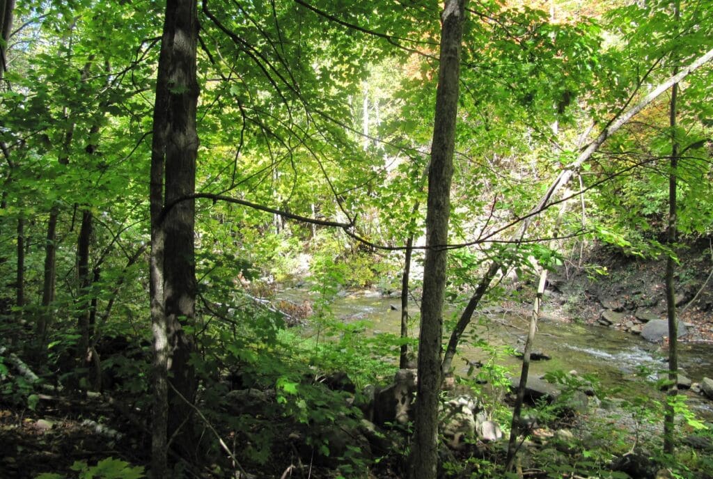
It doesn’t have high-elevation lookout points but offers beautiful forest scenery on a less populated trail open year-round.
Best known for its hardwood bush and huge trees, this is a great spot to see unique nature.
Benches line the path if you want to rest and take in the nature surrounding you.
The entrance is on a side road, so it’s a bit hard to find. I used the AllTrails parking lot directions to get there.
Location: Tehkummah, Ontario
Distance: 3.5 km (2.2 mi)
Difficulty: Easy
Elevation: 70.7 m (232 ft)
4. Bridal Veil Falls Manitoulin Island, Kagawong
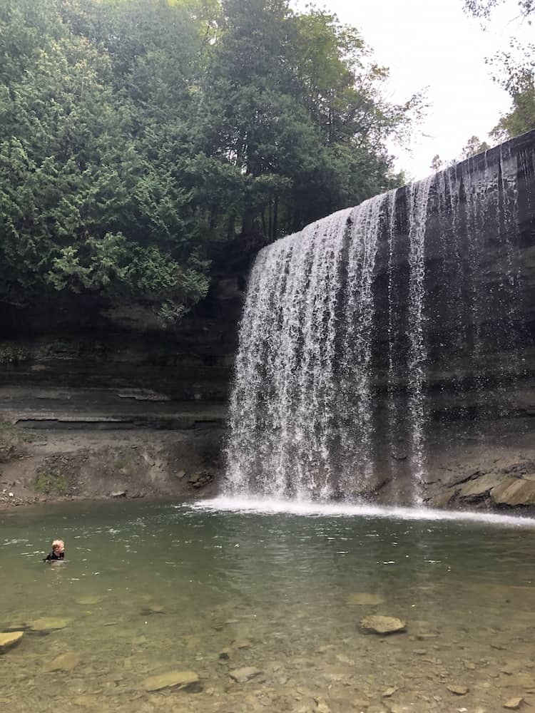
Bridal Veil Falls Trail may be short, but it’s on this Manitoulin hiking trails list because you can actually get in the water, which is such a cool bonus!
Jump through the thin “veil” waterfall and swim in the pool, then continue on any number of connecting trails in the area.
Just watch out for poison ivy along the path!
At the top of the falls, there are picnic tables for lunch, too. I spent all my time at the base of the falls, trying to brave the cold water (I’m a wimp if it’s not super warm). On a hotter day, I’d have been dying for a dip.
Location: Billings, Ontario
Distance: 1.1 km (0.7 mi)
Difficulty: Easy
Elevation: 22.8 m (75 ft)
5. M’chigeeng Trail
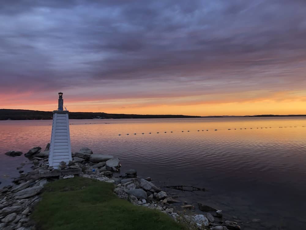
The M’chigeeng Trail is a quiet walking trail with a wonderful windmill along the path. The trail is about 4.6 km (2.9 mi) with only a 132 m elevation gain, which is great for beginner/maderate hikers.
The path has a lot of fallen trees to climb over and around. When you loop back around, there’s a rope to help you climb down the rocks and some stairs to use with caution.
Location: M’Chigeeng 22, Ontario
Distance: 4.6 km (2.9 mi)
Difficulty: Moderate
Elevation: 132 m (433 ft)
6. Bowerman Nature Trails in South Baymouth
Bowerman Nature Trails is a family friendly hiking trail on Manitoulin Island and takes less than 30 minutes to complete.
On this trail, you will be rewarded with fantastic waterside views. There are fun hand-carved totems around the trail, beautiful wildflowers, and fun rock formations to enjoy.
Some of the stairs and bridges have broken planks along the way, so watch your step.
Location: Tehkummah, Ontario
Distance: 1.4 km (0.9 mi)
Difficulty: Easy
Elevation: 18 m (59 ft)
7. Fossil Hill Trail
True to its name, this unique walk on Manitoulin Island takes you by fossils along the trail.
Some of the fossils date back to the Ice Age and are preserved by the Escarpment Biosphere Conservancy.
Location: Escarpment Biosphere Conservancy near Manitowaning Village, Ontario
Distance: 3 km (1.8 mi)
Difficulty: Moderate
Elevation: 20 m (66 ft)
8. Gordon’s Park Loop
This easy hiking loop is located in Gordon’s Park campground, where you can stay in a tent or a cabin.
The campground has many available activities, including mini golf, archery, and a swimming pool.
Gordon’s Park is a dark sky preserve, perfect for a night hike with stargazing.
Location: Tehkummah, Ontario
Distance: 2.4 km (1.5 mi)
Difficulty: Easy
Elevation: 40 m (131 ft)
9. Gore Bay Boardwalk Trail
The Gore Bay Boardwalk Trail is a paved path along the waterfront of Gore Bay. Walk out onto the break wall to get out over the water for a great view.
The Gore Bay Boardwalk Trail is easily accessible, with plenty of photo ops and picnic areas along the way.
Be sure to check out the local restaurants and shops in town after your hike.
Location: North Shore of Manitoulin Island, Ontario, Canada
Distance: 2 km (1.2 mi)
Difficulty: Easy
Elevation: Minimal
10. Kitchitwaa Shkwaandem (Heaven’s Gate) Trail
Heaven’s Gate backpacking trail goes along the La Cloche Mountains in Manitoulin District.
The full trail takes 3-4 days and takes you through white quartzite hills and along multiple lakes. It’s an adventurous trek with multiple rocks to climb over and a mix of easy sections and tough inclines.
Bring your GPS and watch out for bears!
Location: Sagamok, Ontario
Distance: 38 km (23.6 mi)
Difficulty: Hard
Elevation: 1320 m (4,333 ft)
11. Little Current Recreational Walking Trail
Right by a Lighthouse, the Little Current Recreational Walking Trail goes around the entire historic town of Little Current.
Part of the path goes by the North Channel, and there is an exercise park on the same route.
My favorite thing about this trail is the plaques describing the town’s history, built in the 1860s.
Location: Little Current, Northeastern Manitoulin and the Islands
Distance: 12 km (7.4 mi)
Difficulty: Moderate
Elevation: Minimal
12. Misery Bay Inland Alvar Trail
The Inland Alvar Trail is a beautiful, quiet hike that only a few people know about.
Some of Inland Alvar Trail goes by Misery Bay Beach with a unique rock floor. You should do the coastal part of the loop towards the end of your hike. That way, you can enjoy the beach a bit before returning home.
Location: Misery Bay Provincial Park, Burpee and Mills, Ontario
Distance: 7.2 km (4.5 mi)
Difficulty: Easy
Elevation: 158 m (518 ft)
13. Sheshegwaning – Nimkee’s Hiking Trail
Nimkee’s Hiking Trail in Sheshegwaning is a 20 km trail split up into color-coded sections. You can do a shorter 4-4.5 km hike or connect them all for a full-day adventure.
Nimkee’s Hiking Trail is open from April through October and is known for its beautiful North Channel lookout points.
There are campgrounds and picnic sites and plenty of wildlife.
Location: Sheshegwaning First Nation
Distance: 20 km (12.4 mi)
Difficulty: Moderate
Elevation: Minimal
14. Noble Nature Trail
Noble Nature Trail gives you a full view of Gore Bay and ends at Harold Noble Memorial Park.
Stop and take a picture at Easy Bluff Lookout and plan ahead for a lovely picnic at the end of the trail.
Location: Gore Bay
Distance: 1.1 km (0.7 mi)
Difficulty: Easy
Elevation: Minimal
15. Point Grondine Park
Point Grondine Park offers over 18,000 acres to explore in the Wikwemikong Unceded Indian Reserve.
It’s part of the Georgian Bay Coast Trail system and has multiple loops to choose from.
Merv’s Landing Loop is one of the shorter options but is still 7 km long. It isn’t very hard, but be prepared for a solid 4 hours of hiking!
Location: Point Grondine Indian Reserve
Distance: 7 km+ (4.3 miles)
Difficulty: Moderate
Elevation: Varied
16. Wagg’s Woods
Wagg’s Woods in Mindemoya is a short hike that’s part of the Niagara escarpment.
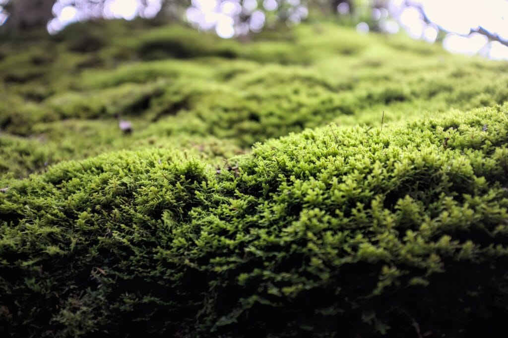
If you love plants, this is the trail for you. You’ll see moss climbing up the escarpment cliffs and at least 15 species of fern growing in the area.
Admire the greenery and enjoy the shade from the 4 main species of trees: maple, ash, birch, and basswood.
Location: Mindemoya
Distance: 1 km (0.6 mi)
Difficulty: Easy
Elevation: Minimal
17. Batman’s Park Loop
Potential Affiliate: https://www.alltrails.com/trail/canada/ontario/batman-s-park-loop
Batman’s Park Loop is part of the northeastern side of Manitoulin Island.
It’s a simple loop trail but a wonderfully quiet walk in nature. Not many people take this trail, so it shouldn’t be too crowded.
The trees are gorgeous in the fall, so bring your camera along and enjoy the scenery!
Location: Northeastern Manitoulin And The Islands
Distance: 1.8 km (1.1 mi)
Difficulty: Easy
Elevation: 30.7 m (101 ft)
18. East Lighthouse/Tar Vat Bay Trail
June through October is the best time to hike the Tar Vat Bay Trail.
The trailhead is at Killarney’s East Lighthouse and continues along Georgian Bay.
You’ll enjoy walking through a beautiful forest. After scrambling over some rocks (always fun), you’ll have an amazing view from Killarney Ridge.
Location: Here
Distance: 3.5 km (2.2 mi)
Difficulty: Easy
Elevation: 86 m (282 ft)
19. Orr’s Mountain Hiking Trail
Orr’s Mountain Hiking Trail begins near Shegulandah Village. The hike is made up of 3 different trails you can complete in about 2 hours.
Orr’s Mountain gives you gorgeous panoramic views of Bass Lake and Sheguiandah Bay. It’s open all year, but remember to pack your snowshoes in the winter!
Location: Sheguiandah
Distance: 3.5 km (2.1 mi)
Difficulty: Moderate
Elevation: 60m (195 ft)
20. Bidwell Bog Trail
If you’re hiking the Cup and Saucer Trail, consider stopping by the Bidwell Bog.
Bidwell Bog Trail is located in the Escarpment Biosphere Conservancy and has a mix of bog and savanna ecosystems. The plants and animals here are unique compared to other areas on Manitoulin Island.
To get to the trail, take Highway 540 or Bidwell Road. You’ll really enjoy this unique route on Manitoulin Island.
Location: Escarpment Biosphere Conservancy
Distance: 5 km (3.1 miles)
Difficulty: Easy
Elevation: Minimal
21. Dan Bingaman Trail
Dan Bingaman Trail is another year-round trail in the Escarpment Biosphere Conservancy by Highway 540.
The climb is along the escarpment outcrops, which provide an amazing cliffside view.
The hike is relatively short but very rewarding!
Location: Escarpment Biosphere Conservancy
Distance: 2 km (1.2 mi)
Difficulty: Easy
Elevation: Minimal
22. Eagle’s Nest Trail
Eagle’s Nest Trail is another trail located in the Escarpment Biosphere Conservancy. You can access the trailhead from McLean’s Park by going up New England Road.
This trail is great for snowshoeing in winter and offers amazing views all year long.
Soak in the beautiful nature of the escarpments, crevasses, pine forests, and gorgeous plains throughout the hike.
Location: Escarpment Biosphere Conservancy
Distance: 8 km
Difficulty: Moderate
Elevation: Unlisted
23. Lewis Twin Peaks Hiking Trail -TRAIL CLOSED
The Lewis Twin Peaks Hiking Trail is a route located in Sheguiandah. It is one of the most popular trails for its gorgeous views, but unfortunately, it closed to the public in 2021 when new owners bought the property.
Location: Sheguiandah
Distance: 2 km (1.2 mi)
Difficulty: Easy hike
FAQs About Hiking Trails Manitoulin Island
How long is Cup and Saucer Trail?
Cup and Saucer Trail is 5.1 km (3.2 mi) and has an elevation gain of 155.7 m (511 ft).
What is special about Manitoulin Island?
Manitoulin Island is the biggest freshwater lake island with rich archaeological history. The island’s name means “spirit island,” and there are 6 indigenous reserves on Manitoulin.
Why is it called Misery Bay on Manitoulin Island?
In the 1880s, a farmer cut marsh grass in the hot summer sun and jokingly called the place “misery” when boaters asked the name of the bay. Now it is forever known as Misery Bay.
What is the best month to visit Manitoulin Island?
The best month to visit Manitoulin Island is September or October. The heat and mosquitoes have died down during this time, but it is also before the winter frost. Plus, the fall leaves are stunning during these months.

Final Thoughts on Hiking Trails on Manitoulin Island
Manitoulin Island hiking offers a wide range of trails, from casual nature walks to challenging backpacking routes. It’s the world’s largest freshwater island, which means amazing waterfront views from most trails.
The Cup and Saucer Trail is fun and popular, while Bebamikawe Memorial Trail is also great because it is less crowded.
Try the Fossil Hill Trail or Bidwell Bog if you are looking for a more unique hike.
Pick your hiking season carefully since some routes are only open in the spring and summer.
There are fun Manitoulin Island summer events, but pack your bug spray to shield yourself from mosquitoes.
Winter gives you beautiful snowy scenic hikes, but not all trails are open, so note which ones are accessible.
Fall is the best time to visit with the cooler (but not freezing) weather and the beautiful fall colors everywhere. So bring your camera and enjoy!
No matter when you embark on a hiking adventure, there is surely something for everyone!
Read More About Ontario
- Best Ontario White Water Rafting Tours
- Top Toronto Wine Tours to Taste Ontario VQA
- Best Places to See Fall Colours in Ontario
- Most Romantic Getaways in Ontario for Couples
- Best Things to Do in Almonte Ontario
- Moving to Quebec from Ontario: Benefits, Costs & More!
- Moving to Ontario from Quebec: Costs, Benefits & More!
- Jaw-Dropping Things to Do Tobermory, Ontario
- Things to Do in Elora, Ontario
- Best Road Trips in Ontario from Toronto: Unforgettable Places You Need to See
- Best Things to Do in Perth, Ontario: Sights, Tourist Attractions, & Restaurants
- Pros and Cons of Living in Ottawa, Ontario
- Ultimate 7 Day Northern Ontario Road Trip Ideas
- Cozy Cabins in Ontario for an Autumn Weekend Getaway
- Amazing Hiking Trails on Manitoulin Island, Ontario
- Best Things to Do on Manitoulin Island
- Hiking the Cup and Saucer Trail: Everything You Need to Know for an Epic Adventure
- Hiking the Bebamikawe Memorial Trail
Canada Travel Planning Guide
🚑 Should I buy Canada travel insurance?
100% YES! — Canada has “free” healthcare but it’s only for citizens! Foreigners visiting need travel insurance in case anything happens on their visit. I recommend World Nomads – starting at just $5 a day!
💧Can you drink the water in Canada?
Yes — In all major cities in Canada, you can drink the tap water. There are very few, rural areas that you can’t. However, you should never drink river or lake water anywhere in the country! I recommend a Brita Water Bottle for long hikes and backcountry camping to stay safe and hydrated.
🚙💨 Is it safe to rent a car in Canada?
Yes — Renting a car is a necessity in most of Canada! If you want to go on road trips or adventures outside of the major cities, you’ll need to rent a car. (Read more)
📲 Will my phone work in Canada?
Maybe — Some American companies work in Canada, but many will not. If your phone doesn’t work in Canada, I recommend getting a Canadian SIM card so you can get around and stay in contact with loved ones. We don’t have a lot of free WIFI in Canada, so you’ll need your phone for maps.
🏩 What’s the best way to book my Canada accommodations?
My go-to for Canadian hotels is Booking.com. For hostels, I use Hostel World. If you want a home-y feeling, check out VRBO (which is cheaper and safer than Airbnb).
Or get free accommodations with Trusted Housesitters!
✈️ What’s the best site to buy Canada flights?
For finding cheap Canadian flights, I recommend Skyscanner.
🎫 Do I need a visa for Canada?
Likely Not — US, UK, and EU passport holders don’t need Canadian visas. However, some other countries do (check here!). And if you plan to stay for more than 4 weeks (an average tourist visa length), you will need to look into visas to live in Canada.